Sierra Nevada National Park
2-Day Summit Mulhacén
Price
160 (6 pax.)
Pre-booking
100%
Minimum of persons
1
Duration Trail
Day 1: 6 hours
Day 2: 6 hours
Tour Type
Guided
Season
Summer
Sierra Nevada National Park
Price
160 (6 pax.)
Pre-booking
100%
Minimum of persons
1
Duration Trail
Day 1: 6 hours
Day 2: 6 hours
Tour Type
Guided
Season
Summer
Total Distance
Day 1: 14 km
Day 2: 11 km
Total Ascent
Day 1: 850 m
Day 2: 1000 m
Total Descent
Day 1: 885 m
Day 2: 800 m
Route Type
Point-to-point
Physical Difficulty
Day 1: B+
Day 2: C+
Qualified Mountain Leader
Liability insurance and assistance
Transfer
1 night at the mountain refuge
Picnic: first and second day
Breakfast: second day
Dinner: first day
Minibus second day
Snack
Minibus first day (Optional)
Summer ski lift first day (Optional)
You can use a minibus or summer ski lift on the first day, which leaves us at around 3.000 meters, significantly reducing ascent, distance, and the route's demands. Ask for more information.
Acclimatize, and spend the night before at the mountain refuge at 2.500 meters, the starting point of the ascent.
Summer
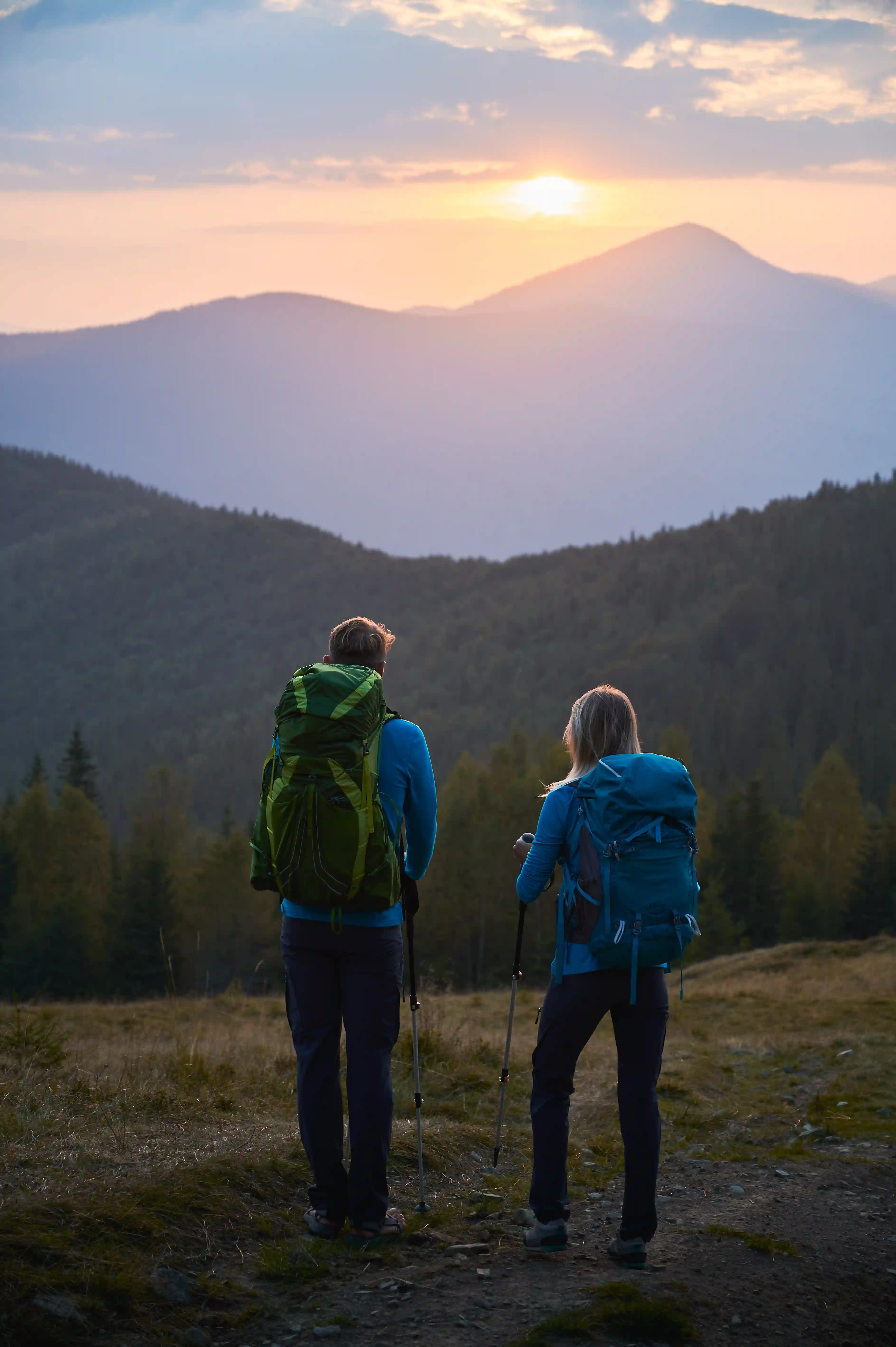
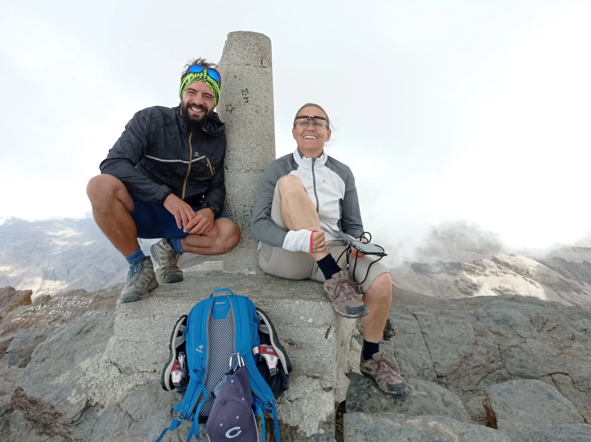
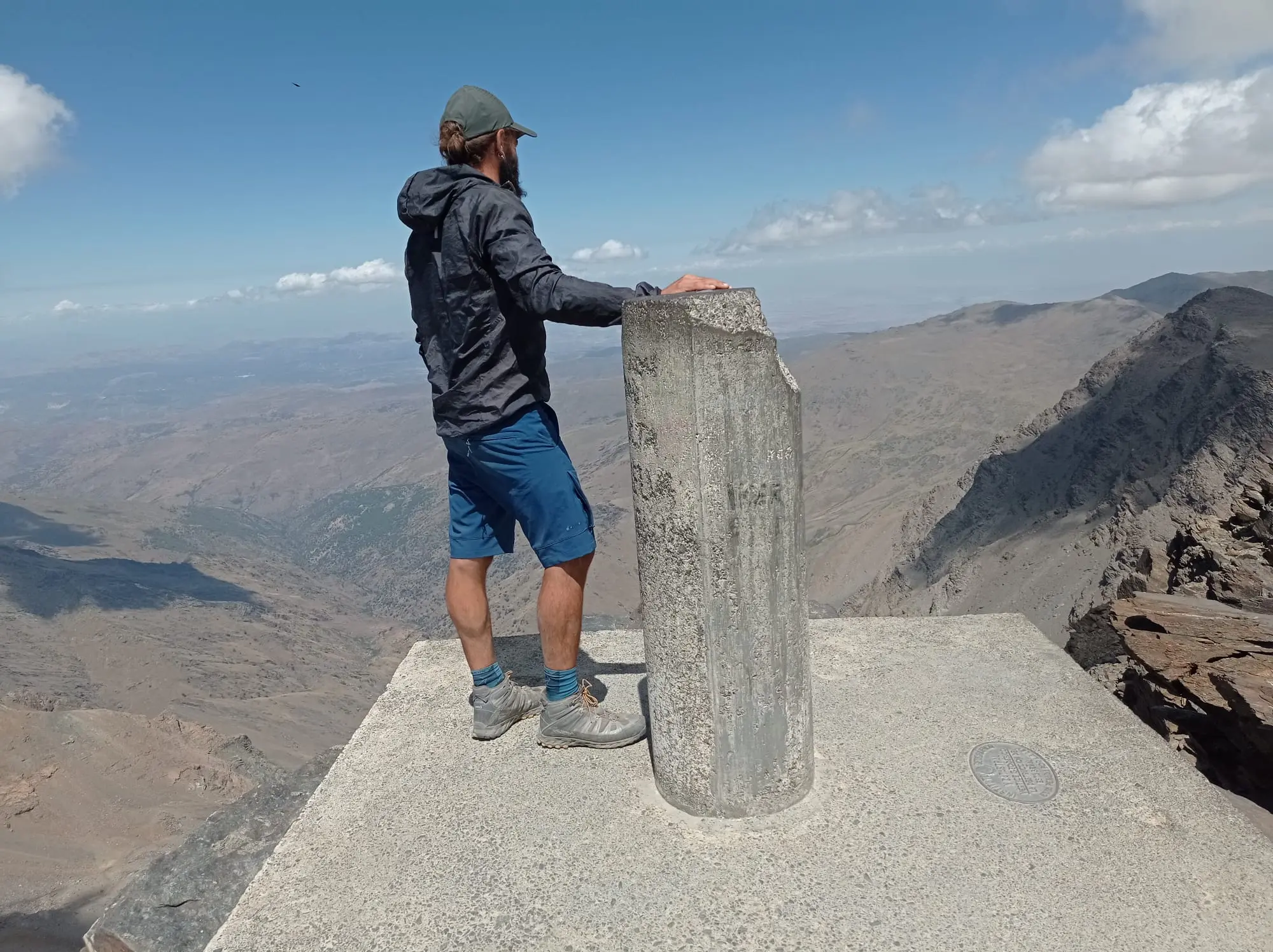
🔹 Climb the highest peak of mainland Spain, Mulhacén 3.480 m.
🔹 Stunning mountain landscape and glacier lakes
🔹 Sleeping at the mountain refuge
Weather is important to consider while packing for your outdoor activity. Your packing list is based on your comfort and sensitivity. Layering your clothes is the best way to travel and be outdoors. It is highly recommended as the best way to stay warm and cool, as the weather is bound to change in the mountains.
🔹 Water minimum 2 L
🔹 Picnic (sandwich, chocolate, dried fruit, etc.)
🔹 Light backpack (20-30L)
🔹 Weather-appropriate and technical clothing
🔹 Hiking jacket
🔹 Hiking shoes
🔹 Sun protection
🔹 Sunglasses
🔹 Hiking summer hat or cap
🔹 Trekking gloves
🔹 Warm hat and neck gaiter
🔹 Trekking poles (Recommended)
🔹 Headlamp
If you have any questions about the material's recommendations, contact us or check out our blog, “What to Bring for Hiking.”
🔹 Physical fitness: Good, with the habit of doing aerobic sports.
🔹 Proper hiking equipment is required. Walking sticks are recommended, and ankle-high hiking boots are strongly recommended.
🔹 Previous mountain hiking experience: recommended.
We recommend having a good rest and better acclimatization at the mountain refuge the night before to avoid any symptoms of altitude sickness.
- Evaluate your state of fitness.
- The best way to prepare yourself is to hike and carry a backpack with some weight.
For more information check our blog and look for “How to prepare physically for a hike”
The weather in the Sierra Nevada during the summer has an average temperature of 24ºC and quite warm days. At 3.000 meters, the temperatures might vary between 15ºC and 20ºC, and at night, the temperature drops to 10ºC.
We drive from the city of Granada to the mountain refuge at 2.500 meters. (approximately 1 hour drive)
Cancel up to 48 hours before the start of the activity and you will receive a full refund
See Terms and Conditions
Our hiking tour prices vary depending on the number of participants. This helps us offer fair and flexible pricing, while ensuring a high-quality, personalized experience for every group.
Special pricing is available for families and larger groups. Contact us for more information.
We offer two variations, with each a different physical difficulty, to climb the Mulhacén peak.
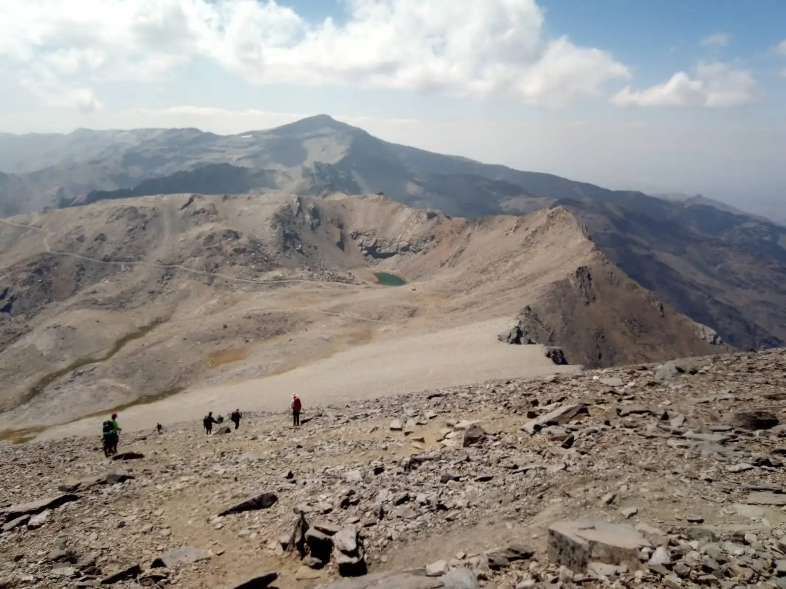
The route starts at Europe’s southernmost ski resort and follows a great ascent along the San Juan Valley towards the second-highest peak of the mountain range, Veleta 3.392 meters. The trail brings you to the Carihuela Refuge located in the mountain pass “Collado de la Veleta” on its southern slope at an altitude of 3.200 meters where you can see the remains of the trenches from the Civil War.
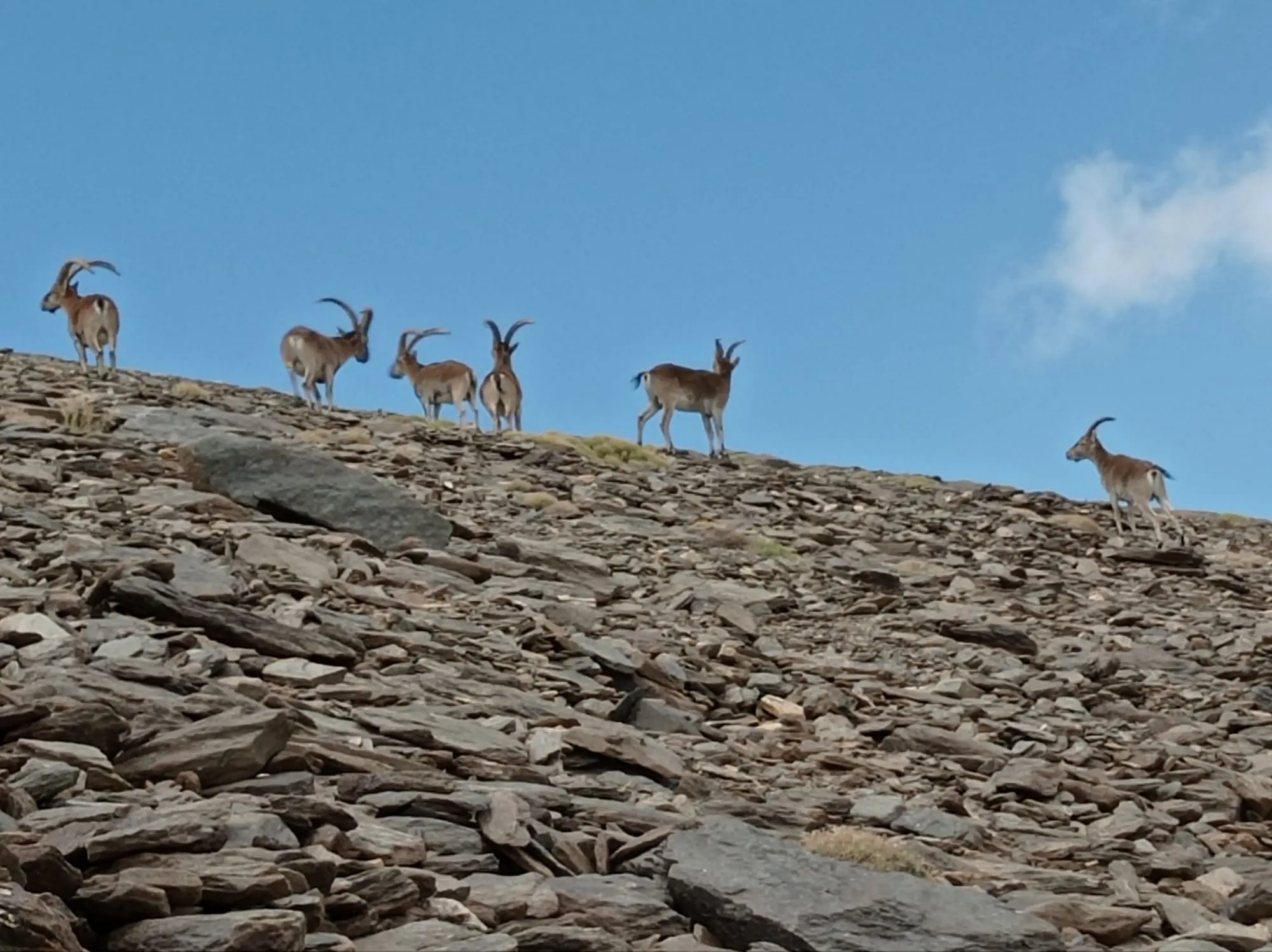
Before our eyes, a wide landscape of the Mediterranean mountain range opens, and the peak Mulhacén rises majestically. The trails continue to the “Caldera Lagoon” of glacial origin and one of the most emblematic lagoons in the Sierra Nevada. From the mountain refuge, the iconic steep climb awaits us up to the peak of Mulhacén. We take the same path to return to the mountain village.
We classify the north-face route as a moderate + trail and has characteristics of altitude hiking. The hike involves a significant height difference with a long ascent and descent divided into two parts during the entire hike. A steep summit climb on rocky and loose terrain. The descent is less strenuous but can be tough on the knees. The trail doesn’t have any technical obstacles. For more information check our blog and look for “Trail grades”
Optional: there is a minibus or the summer ski lift at your disposal, which leaves us at around 3.000 meters, a significant reduction of ascent, distance, and the demands of the route. Ask for more information.
14 Km
850 m
885 m
Point-to-point
B+
After breakfast at the refuge, we start the emblematic ascent to the Mulhacén peak.
From the refuge, we hike gradually up toward Caldera Lagoon following the Mulhacén River through alpine meadows and rocky terrain, with panoramic views of the surrounding mountains and valleys.
One of the most emblematic lagoons in the Sierra Nevada, Caldera Lagoon, sits below the ridges of Mulhacén. After having a rest at the mountain refuge, the iconic steep climb awaits us up to the peak of Mulhacén. Once at the summit, you’ll be rewarded with breathtaking views of the surrounding peaks and valleys.
After enjoying your time at the summit, we begin the descent back along the south slope of Mulhacén to 2.700 meters altitude where we take the shuttle bus back to the village of Capileira in the Alpujarra region.
After relaxing with a drink and a tapa in the white village we drive back to Granada.
We classify the route as a challenging trail with characteristics of altitude hiking. The hike involves a considerable height difference with an ascent at the beginning and later a steep summit climb on rocky and loose terrain. The descent is less strenuous but can be tough on the knees. The trail doesn’t have any difficult obstacles. For more information check our blog and look for “Trail grades”
11 Km
1000 m
800 m
Point-to-point
C +